 |
|
 |
 |
 |
 |
 |
 |
|
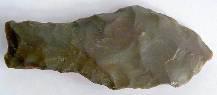
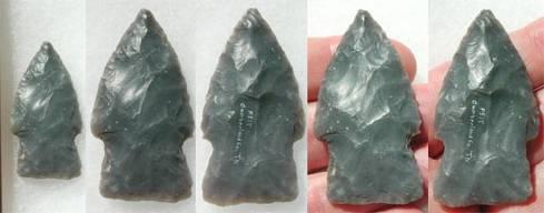
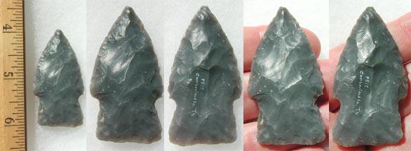
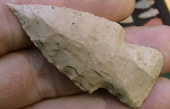
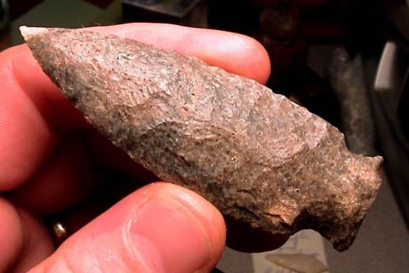
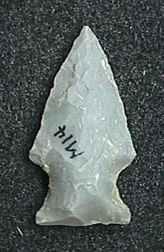
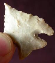
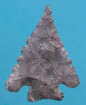
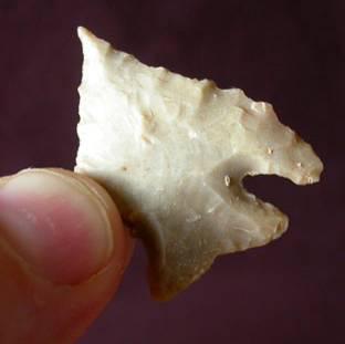
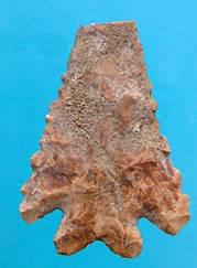
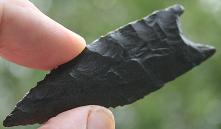
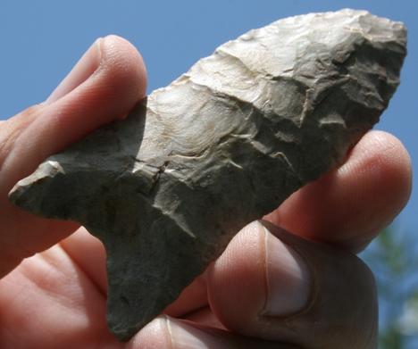
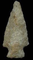
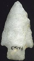
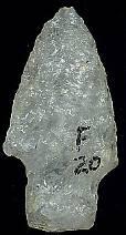
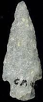
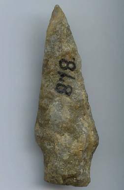
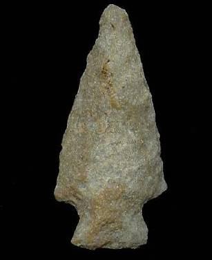
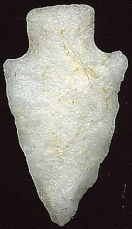
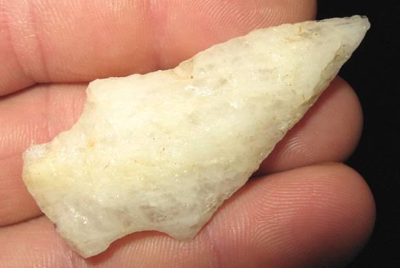
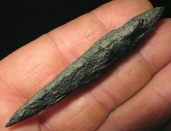
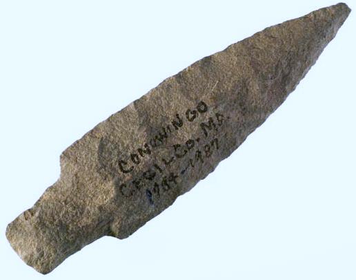
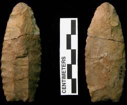
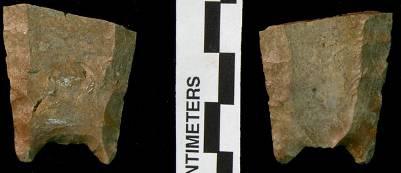
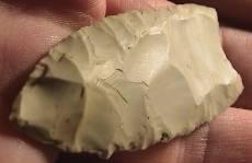
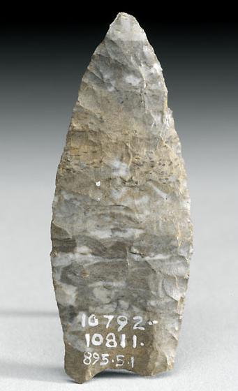
Badin Associated Dates: 1500 – 1000 Y.B.P
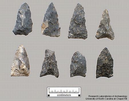
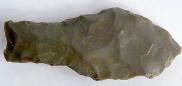
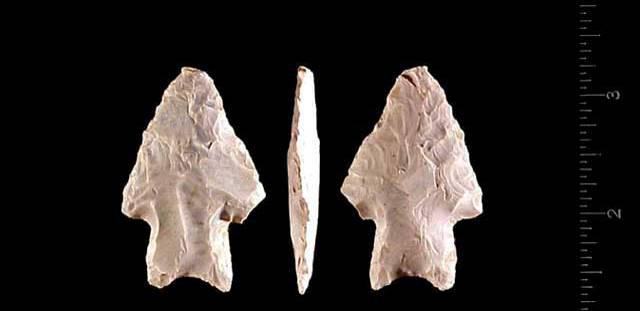
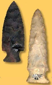
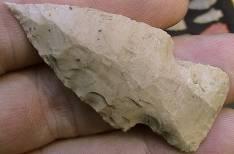
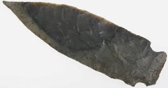
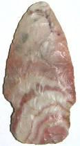
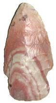
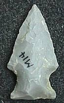
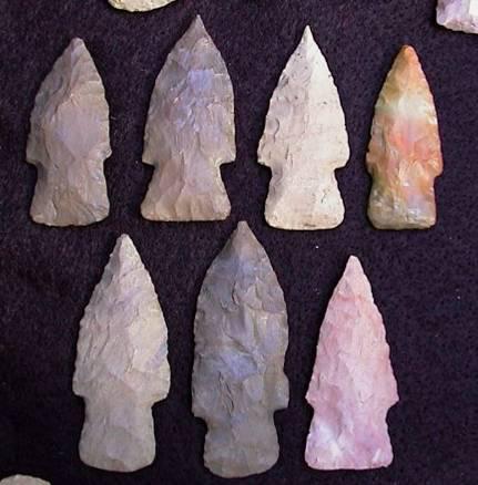
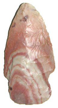
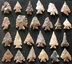
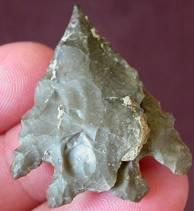
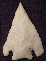
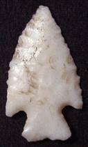
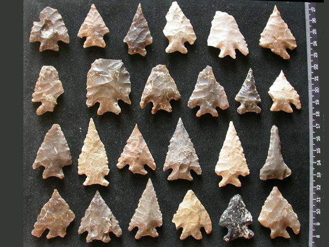
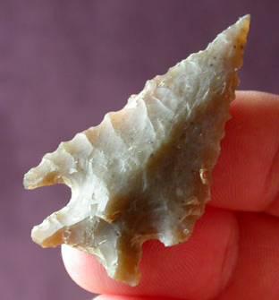
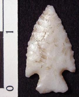
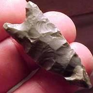
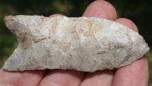
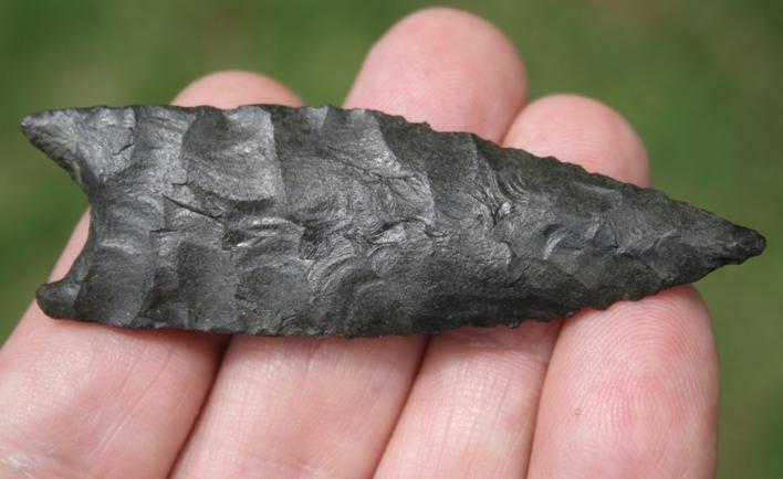
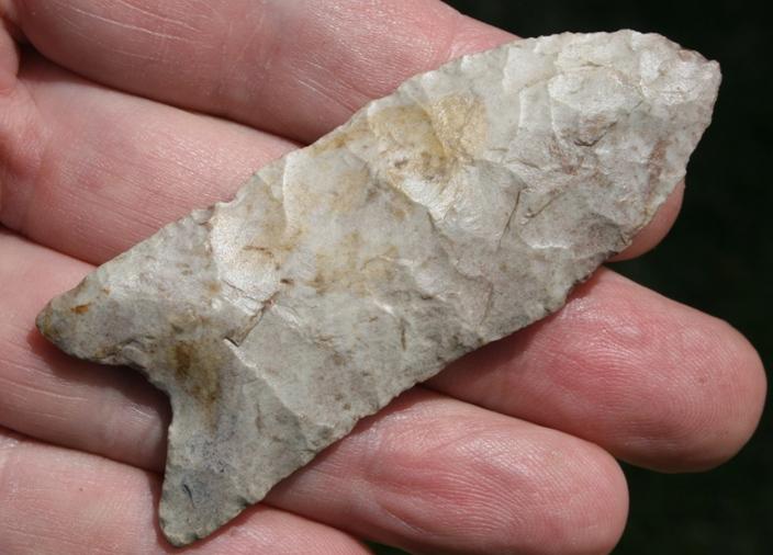
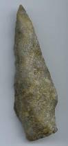
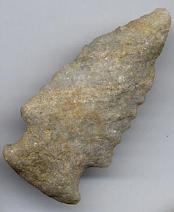
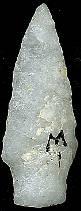
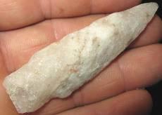
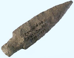
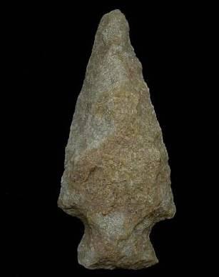
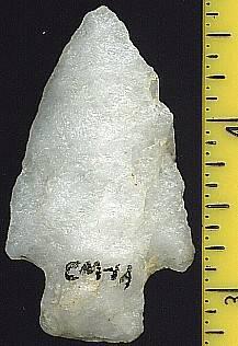
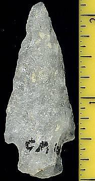
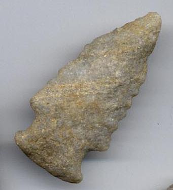
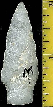
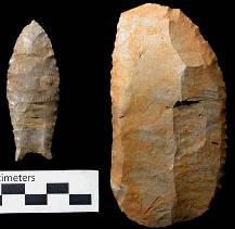
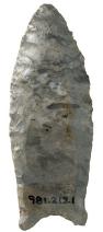
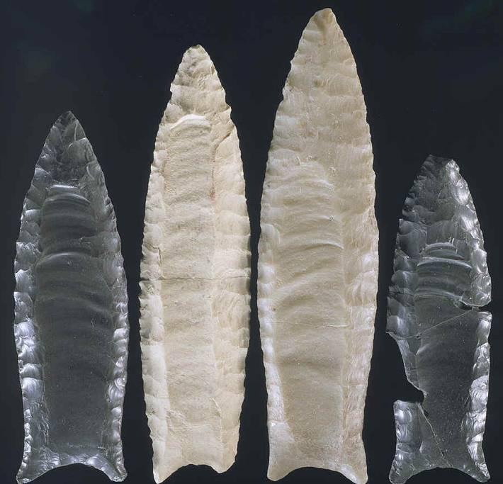
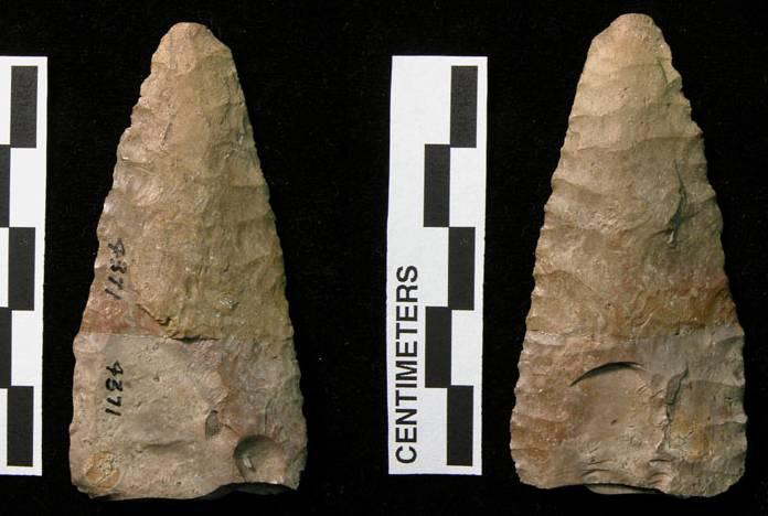
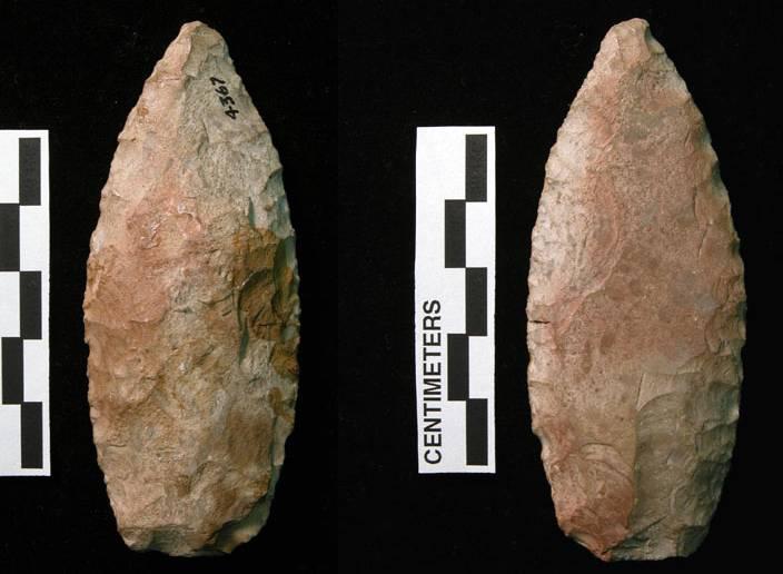
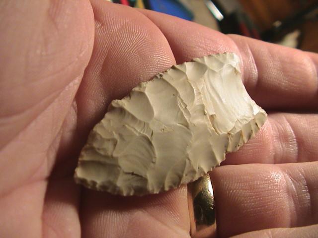
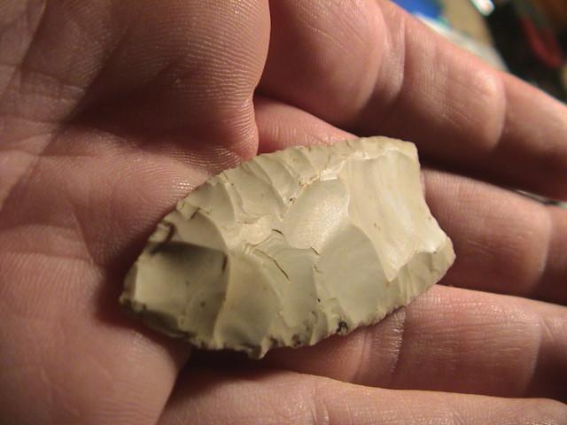
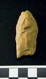
ABOVE: BADIN01: Badin points. Source: North Carolina Office of State Archaeology/Dr. Billy Oliver, U. of N.C. Bajada Associated Dates: 3000 – 1000 Y.B.P
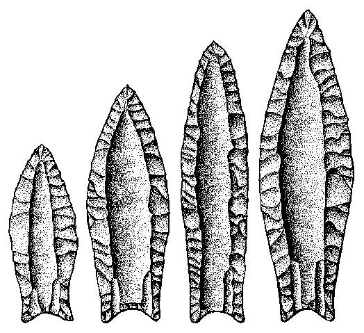
BAJADA POINT THUMBNAIL GALLERY (12 images: 6 source images/6 thumbnails)
End of Bajada Thumbnails - Complete
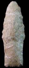
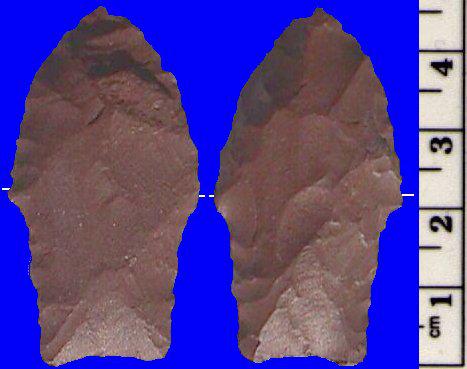
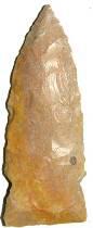
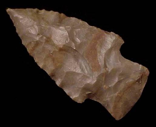
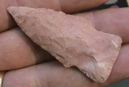
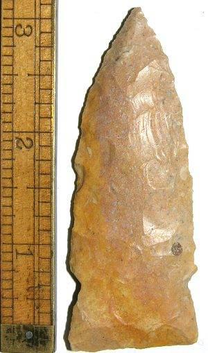
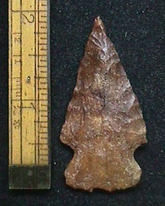
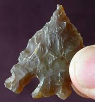
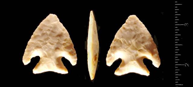
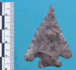
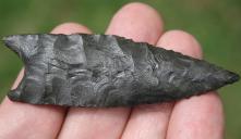
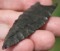
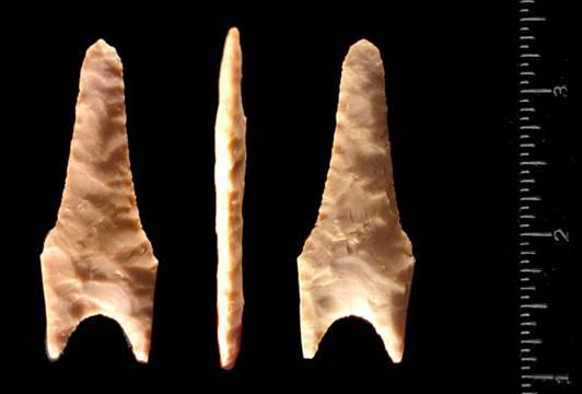
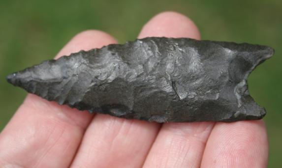
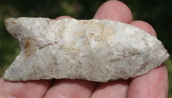
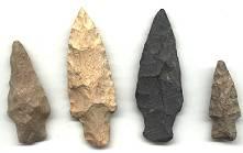
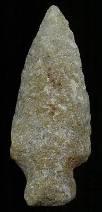
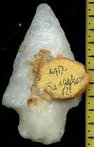
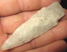
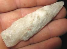
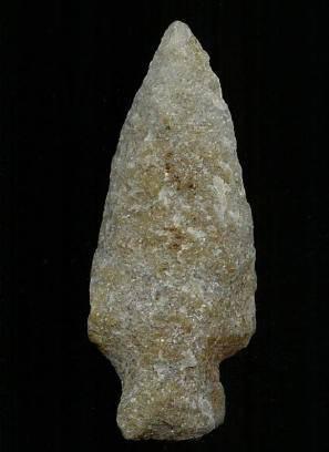
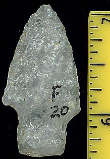
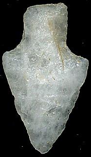
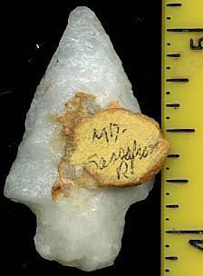
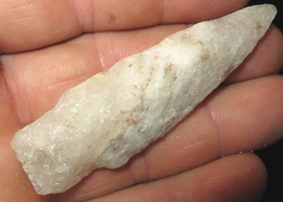
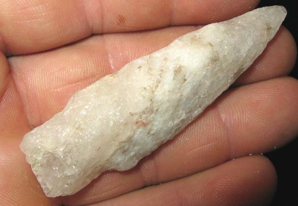
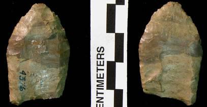
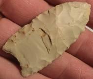
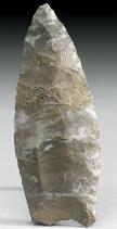
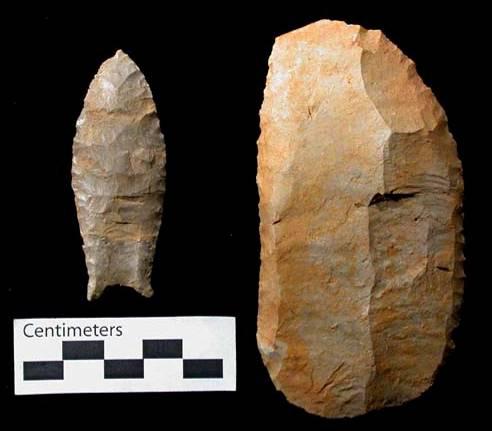
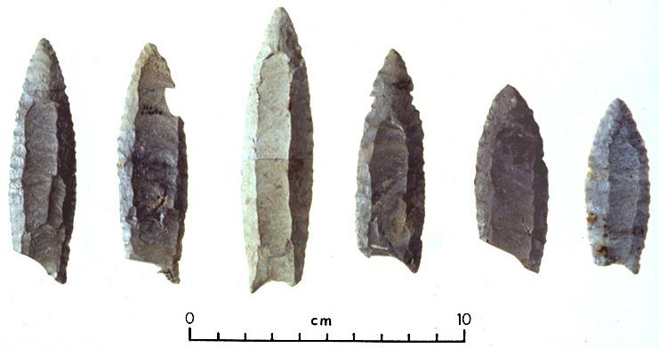
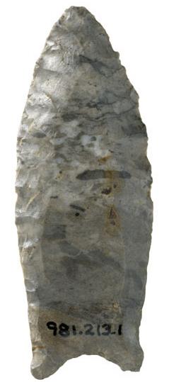
ABOVE: BAJ01 AND BAJ02: Bajada point; Colorado; 2.25 inches (56.25mm); shown approximately life-size at right
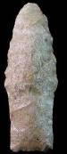
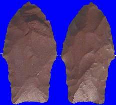
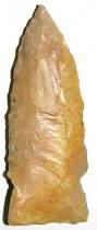
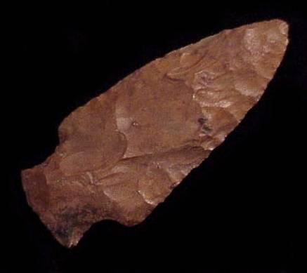
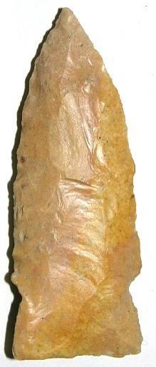
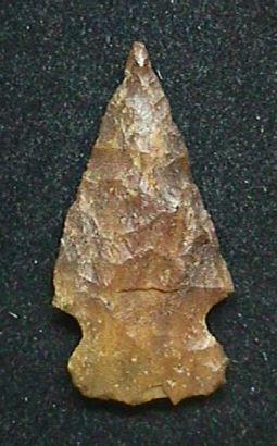
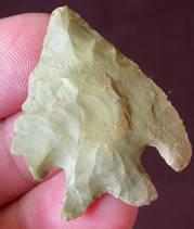
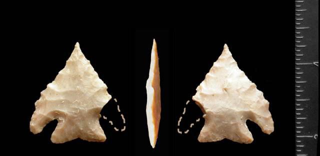
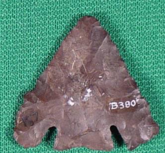
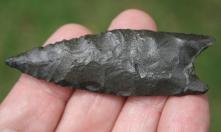
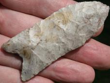
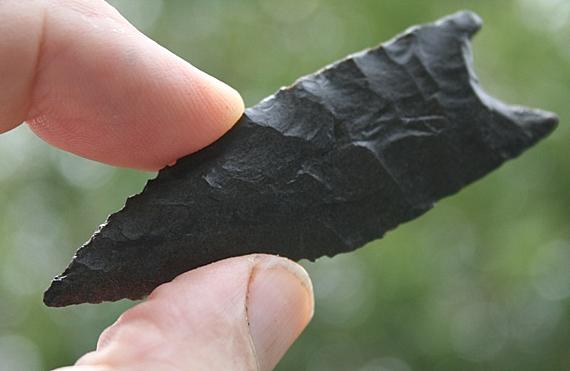
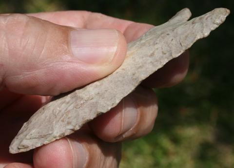
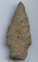
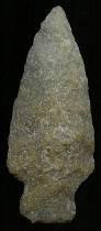
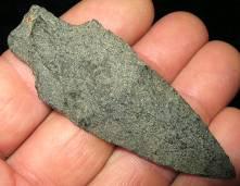
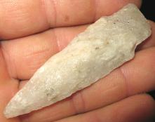
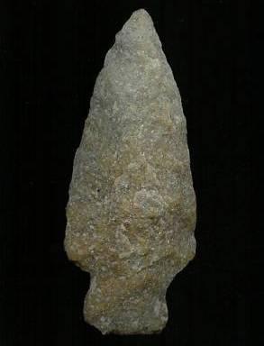
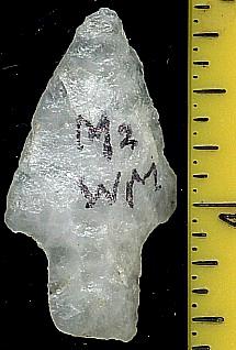
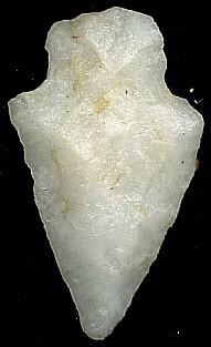
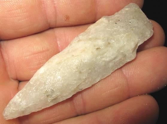
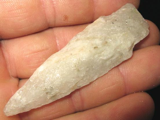
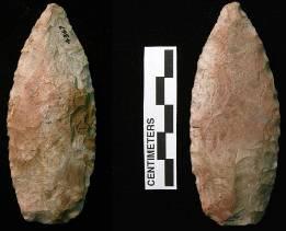
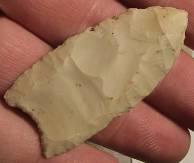
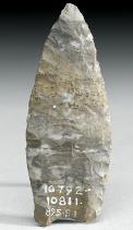
ABOVE: BAJ03 (TOP) AND BAJ04: Bajada point; Padilla Wash, Chaco Culture National Historic Park, Colorado; 2.24 inches (56mm); National Park Service collection; shown approximately life-size in smaller image
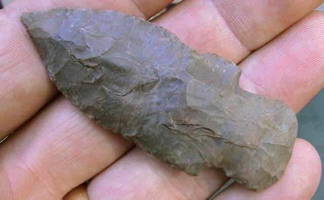
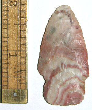
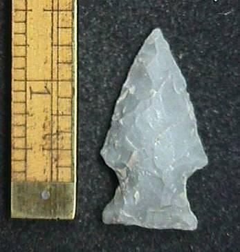
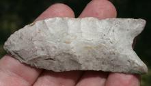
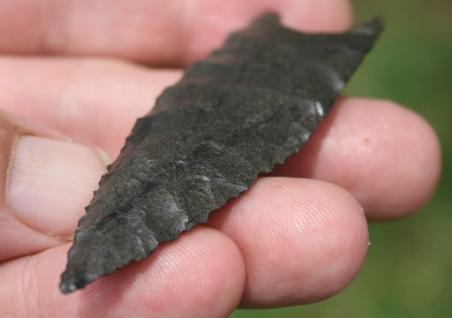
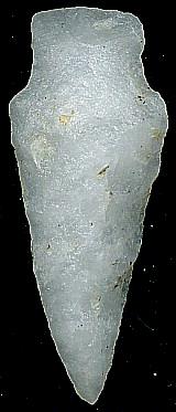
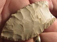
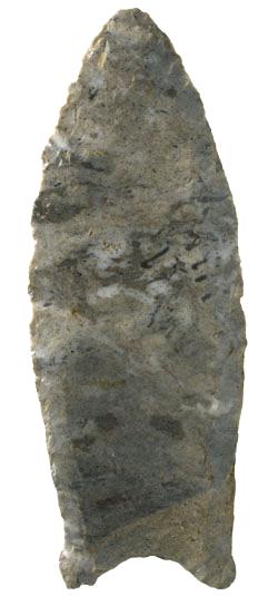
ABOVE: BAJ05: Bajada point; no details
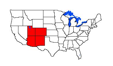
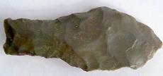
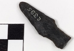
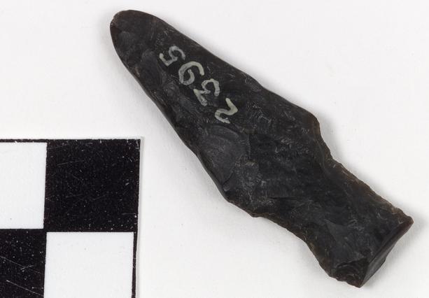
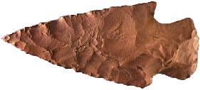
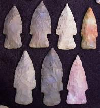
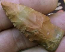
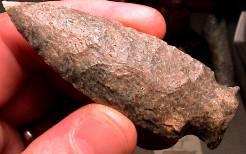
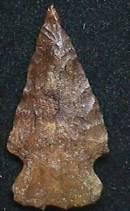
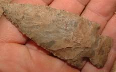
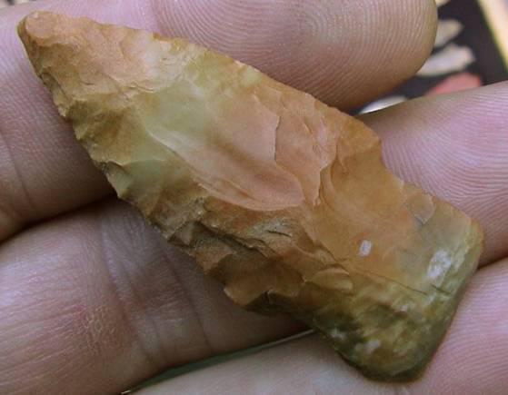
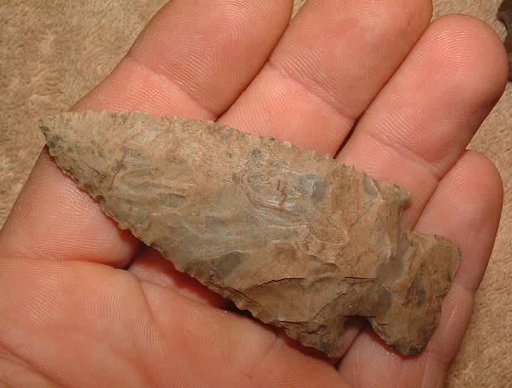
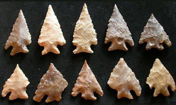
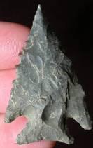
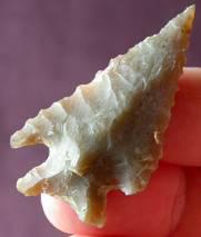
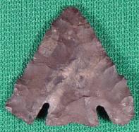
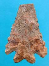
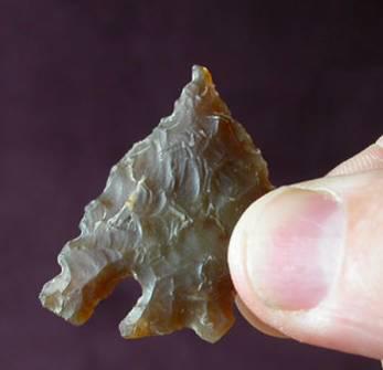
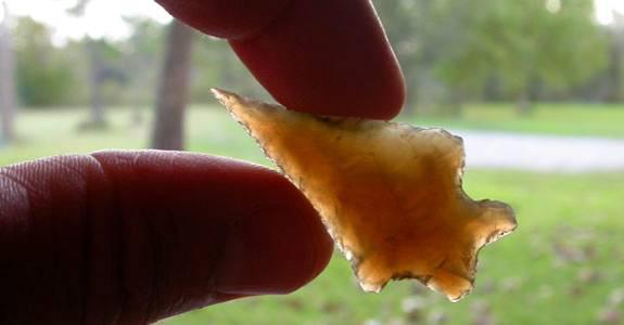
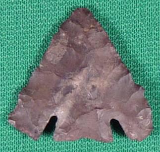
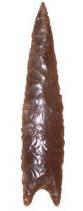
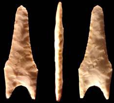
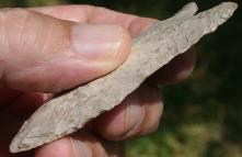
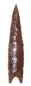
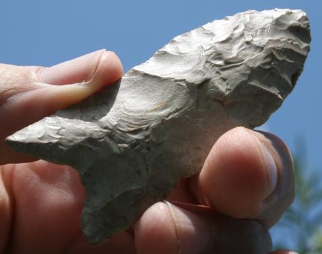
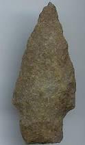
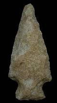
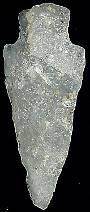
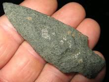
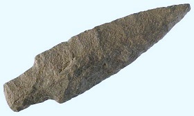
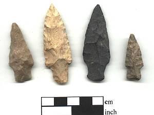
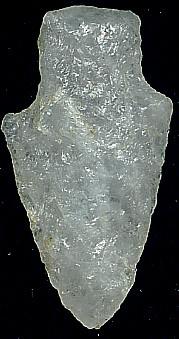
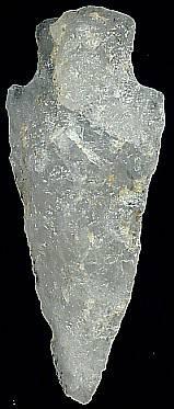
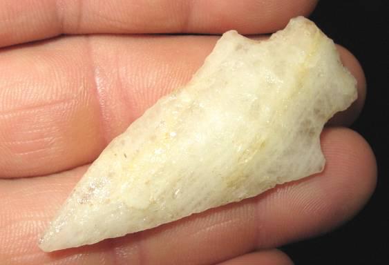
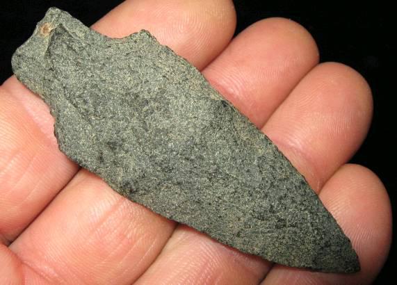
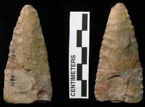
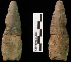
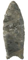
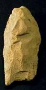
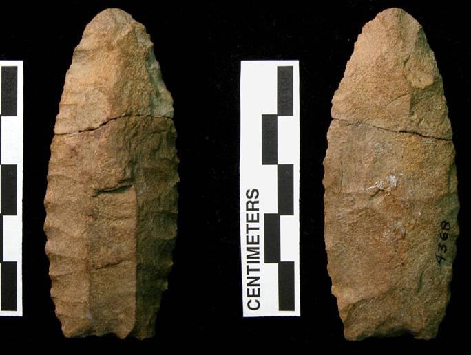
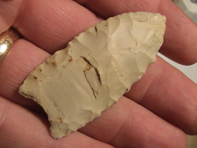
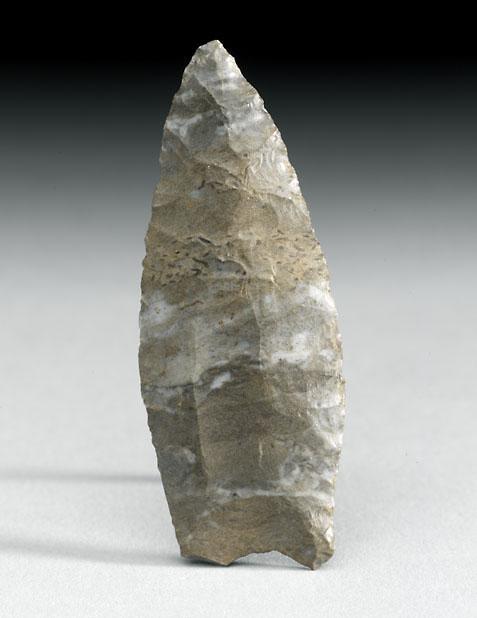
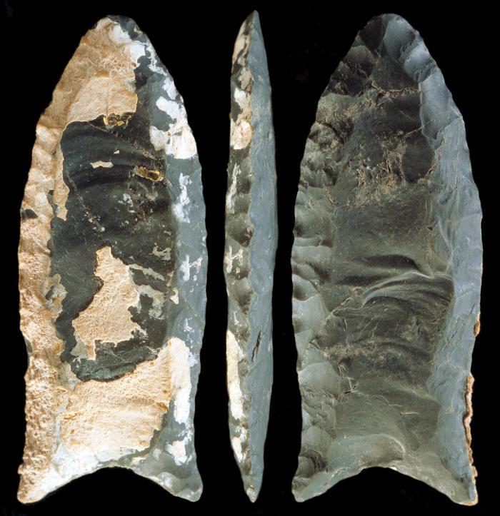
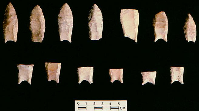
ABOVE: BAJ06: Bajada spear point; Ganado, Navajo Reservation, Apache Co., Arizona; basalt; attributed age given as 6000 – 3300 BC; catalogue # 2395. Source: National Museum of the American Indian, Smithsonian http://www.americanindian.si.edu End of Bajada Complete Baker Associated Dates: 8000 – 6000 Y.B.P.
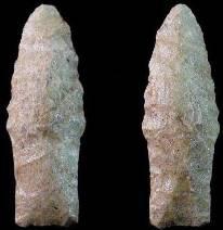
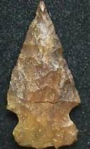
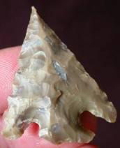
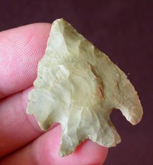
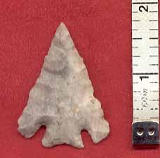
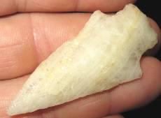
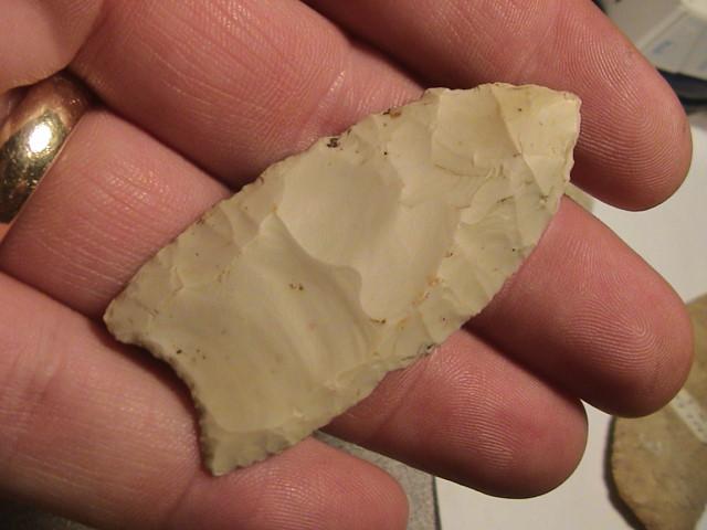
ABOVE: BAKER01: Baker point; Texas; no other details. Source: Texasarrowheads dot com
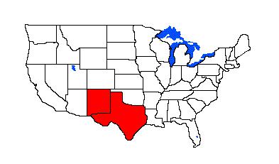
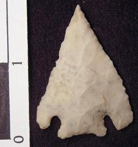
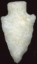
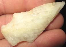
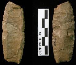
ABOVE: BAKER02: Baker point; Texas; no other details. Source: Texasarrowheads dot com End of Baker Complete Bakers Creek Associated Dates: 2500 - 1200 Y.B.P. Location: Southeastern United States Morphology: Stemmed - Expanding
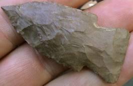
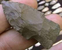
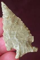
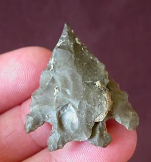
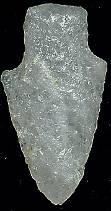
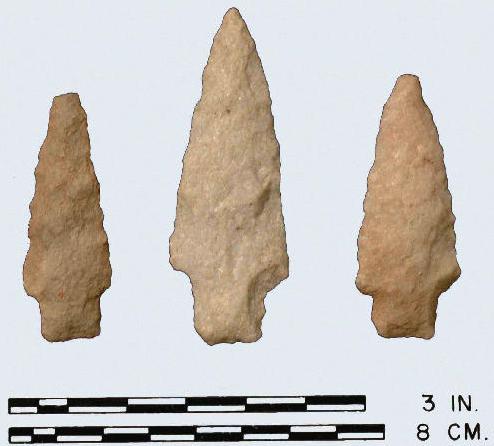
*THE BAKERS CREEK POINT: According to Justice, the Bakers Creek point differs chiefly from the Lowe Flared Base in that the former lacks the latter's hexagonal cross section. According to Justice, "sThe Lowe Flared Base type is closely related to Bakers Creek of the Tennessee Valley and represents a stimulus from that region." It is also interesting to note Justice's description of the Bakers Creek point's distribution – which is also at odds with that given by Gumbus (see below, following). According to Justice (1987; "Stone Age Spear and Arrow Points of the Midcontinental and Eastern United States"): They…."are common at sites along the Tennessee River Valley in Tennessee and Alabama….They are also typical at sites of the period such as Tunacunnhee and St. Catherines Island in Georgia, Mississippi, Louisiana, Kentucky and West Virginia.…Seeman….has identified the type in the Ohio Valley and it is known to occur sporadically throughout this region at a variety of terminal Middle Woodland sites. One major centre where these points occur is the Mann site in Posey County, Indiana." The following section is Art Gumbus’ description of the Bakers Creek point General Description: The Bakers Creek is a small to large sized expanding stemmed dart point with tapered to barbed shoulders that are typically narrow. The Bakers Creek has a large, broad expanded stem with either a straight or convex slightly ground and thinned basal edge. The basal edge is sometimes almost as wide as the widest blade dimension. The stem was formed by notching into the blade about one-third of the way from the base which formed a long expanded stem and squared shoulders. This diagonal notch tapers from the basal edge which oftentimes remains unmodified in width as mentioned above. Flake scars indicate that a strong percussion method was used to notch the hafting area and to form the expanding stem. All blade edges appear to have been retouched as a final step in shaping the point. The blade outline is triangular or lanceolate. The blade is medium in width with unbeveled edges and was formed by broad random percussion flaking. The blade most often terminates in an acute or an acuminate distal tip with the proximal end having small, horizontal, inversely tapered or tapered barbs. The cross-section is biconvex.
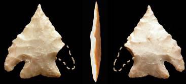
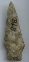
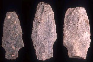
ABOVE: BAKCRK01: Bakers Creek points; no details/span> This type has been called a "Stemmed Copena" (Cambron, 1958) and has been found with Copena points in caches. The Bakers Creek is called the Lowe and Steuben in southern Illinois**. The Bakers Creek is found primarily along the Tennessee River Valley in Tennessee and in parts of northern Alabama, northern Mississippi and western Kentucky. The Bakers Creek size range is from 32 mm to 105 mm in length. The width varies from 19 mm to 36 mm. The stem width ranges from 19 mm to 26 mm. The stem length can run from 14 mm to 16 mm long. Typical overall thickness is 6 mm to 8 mm. The Bakers Creek type was named by James W. Cambron in 1962 for examples found at a site at the mouth of Bakers Creek, Morgan County, Alabama.
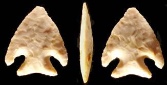
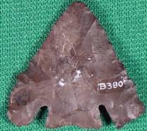
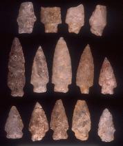
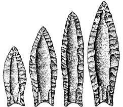
ABOVE: BAKCRK02: Bakers Creek point; see description below The point pictured is an average-sized Bakers Creek point which is made from a dark brown matte chert. The point measures 73 mm in length and measures 32 mm at its widest point which is across the barbs. The maximum blade thickness is 8 mm. The stem is 16 mm long and is 23 mm wide at the base which is slightly ground. It appears that the lower or left barb has been clipped or nicked off historically. The point was found near the town of Ramer, McNairy Co., Tennessee. (TEXT SOURCE: Art Gumbus, Lithics-Net) BAKERS CREEK POINT THUMBNAIL GALLERY (46 images: 23 source images/23 thumbnails)
End of Bakers Creek Thumbnails - Complete
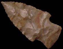
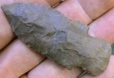
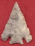
ABOVE: BAKCRK03: Bakers Creek point; Lauderdale Co., Alabama; 2.25 inches (56.25mm)
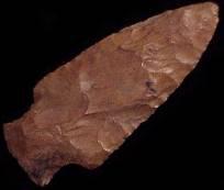
ABOVE: BAKCRK04: Bakers Creek point; Lauderdale Co., Alabama; 2.5 inches (62.5mm); red jasper
ABOVE: BAKCRK05: Bakers Creek point; Cumberland Co., Tennessee. Source: Westernartifacts dot com
ABOVE: BAKCRK06: all Bakers Creek points; Tennessee River, Decatur Co., Tennessee; found at same campsite; see close-up shots of six of the seven points below; first of seven images
ABOVE: BAKCRK07: second of seven images of Bakers Creek point group described in frame #05; 2.25 inches (55mm)
ABOVE: BAKCRK08: third of seven Bakers Creek point described above in frame #05; 2.0 inches (50mm)
ABOVE: BAKCRK09: fourth of seven Bakers Creek points in the group shot described in frame #05; 2.0 inches (50mm)
ABOVE: BAKCRK10: one of the seven Bakers Creek points in the group shot described in frame #05; 2.0 inches (50mm)
ABOVE: BAKCRK11: one of seven Bakers Creek points described in frame #05; 2.63 inches (65.75mm
ABOVE: BAKCRK12: one of seven Bakers Creek points in the group shot described in frame #05; 2.25 inches (56.25mm)
ABOVE: BAKCRK13: Bakers Creek point; Tennessee; 4.13 inches (103.25mm)
ABOVE: BAKCRK14: Bakers Creek point; Madison Co., Alabama; 3.13 inches (78.25mm)
ABOVE: BAKCRK15 AND BAKCRK16: Bakers Creek point; Boone Co., Missouri; 3.0 inches (75mm)
ABOVE: BAKCRK17 AND BAKCRK18: Bakers Creek point; central Missouri; 2.0 inches (50mm)
ABOVE: BAKCRK19 AND BAKCRK20: St. Clair Co., Illinois; 2.0 inches (50mm)
ABOVE: BAKCRK21 AND BAKCRK22: Bakers Creek point; Massac Co., Illinois; 1.5 inches (37.5mm)
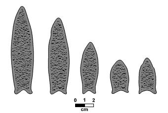
End of Bakers Creek - Complete Bandy Associated Dates: Early Archaic: 8000 - 6000Y.B.P. General Description: Bandy - Named by J.H. Word from examples found at Baker Cave in Val Verde County, Texas. A small to medium size point with slightly convex or recurved edges. Strong barbs created by small V-shaped base/corner notches angled "inward" which creates a stem that expands toward the base. The base often has a "fishtail" appearance. Generally well made and thin. Turner & Hester note that the Bandy may be the Lower Pecos equivalent of the Martindale type of Central Texas. And some typological guides refer to the Bandy as a small Martindale. Both forms will be treated as separate until or if a definitive determination is made. BANDY POINT THUMBNAIL GALLERY (40 images: 20 source images/20 thumbnails)
End of Bandy Thumbnails - Complete
ABOVE: BY01: Bandy point; Texas. Source: Texasarrowheads dot com
ABOVE: BY02: Bandy point; Texas. Source: Texasarrowheads dot com
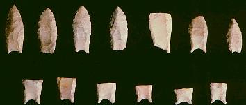
ABOVE: BY03: a frame of Bandy points; all from Spicewood, Burnet Co., Texas; first of 11 images. Source: David Crain, Texasarrowheads dot com
ABOVE: BY04: second of 11 views: the best 10 examples from the frame of Bandy points described above in frame #3. Source: David Crain, Texasarrowheads dot com
ABOVE: BY05 AND BY06: third and fourth of 11 views from the frame of Bandy points described above in frame #3. Source: David Crain, Texasarrowheads dot com
ABOVE: BY07 AND BY08: fifth and sixth of 11 views from the frame of Bandy points described above in frame #3 (point at left missing left wing). Source: David Crain, Texasarrowheads dot com
ABOVE: BY09 AND BY10: seventh and eighth of 11 views from the frame of Bandy points described above in frame #3 (point at left missing right wing). Source: David Crain, Texasarrowheads dot com
ABOVE: BY11 AND BY12: ninth and tenth of 11 views from the frame of Bandy points described above in frame #3. Source: David Crain, Texasarrowheads dot com
ABOVE: BY13: eleventh of 11 views from the frame of Bandy points described above in frame #3 (fine edge retouch can be seen in this view). Source: David Crain, Texasarrowheads dot com
ABOVE, LEFT: BY14: Bandy point; no details
ABOVE, LEFT: BY15: Bandy point; Val Verde Co., Texas
End of Bandy - Complete Barber Associated Dates: 10,000 – 7000 Y.B.P.
BARBER POINT THUMBNAIL GALLERY (26 images: 13 source images/13 thumbnails)
End of Barber Thumbnails - Complete
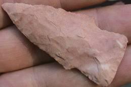
ABOVE, LEFT: BARBER01: Barber point; Texas; slightly over 5.0 inches (127mm)
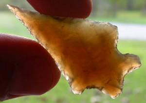
ABOVE: BARBER03: Barber point, heavily resharpened; Texas. Source: Texasarrowheads dot com
ABOVE: BARBER04: Barber point; central Texas; 3.0 inches (76.2mm); first of four views. Source: Roadrunnerartifacts dot com
ABOVE: BARBER05: second of four views of Barber point described above in frame #04. Source: Roadrunnerartifacts dot com
ABOVE: BARBER06: third of four views of Barber point described above in frame #04. Source: Roadrunnerartifacts dot com
ABOVE: BARBER07: fourth of four views of Barber point described above in frame #04. Source: Roadrunnerartifacts dot com
ABOVE: BARBER08: Barber point; Uvalde Co., Texas; 3.0 inches (76.2mm); first of six views. Source: Roadrunnerartifacts dot com
ABOVE: BARBER09: second of six views of Barber point described above in frame #08. Source: Roadrunnerartifacts dot com
ABOVE: BARBER10: third of six views of Barber point described above in frame #08. Source: Roadrunnerartifacts dot com
ABOVE: BARBER11: fourth of six views of Barber point described above in frame #08. Source: Roadrunnerartifacts dot com
ABOVE: BARBER12: fifth of six views of Barber point described above in frame #08. Source: Roadrunnerartifacts dot com
ABOVE: BARBER13: sixth of six views of Barber point described above in frame #08. Source: Roadrunnerartifacts dot com End of Barber - Complete Bare Island
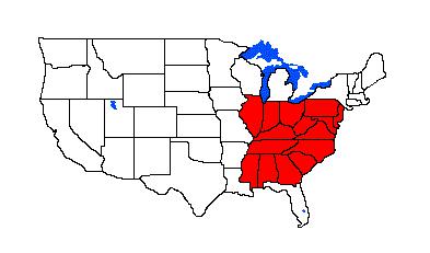
Associated Dates: 4500 - 1500 B.P. - Late Archaic Location: Northeastern United States Morphology: Stemmed General Description: "The Bare Island point is a stemmed, medium to large sized, finely flaked point having a slender isosceles triangular shaped blade. The stem is straight with generally parallel sides and the basal edge is also straight. The blade is usually slender in shape although extreme narrow-bladed examples are in the minority. The blade can exhibit considerable symmetry. Some blades show asymmetry with one blade edge being straight and the other being excurvate. The blade edges are generally straight to convex with the edges of larger specimens tending to be straighter. Greatest convexity usually occurs at the middle of the blade. Tips are sharply pointed and are always on center with the stem although there is no distinct medial ridge. Points made of quartz are thicker that those manufactured from other lithic materials. Probably this is a function of the way quartz flakes, rather than a trait of the cultural significance. Shoulders are slightly rounded and tapered but not conspicuously so. On a few specimens the shoulders are quite sharply angled and well defined but may have asymmetrical shoulders and some specimens have a shoulder totally missing. An obtuse angle is formed between the blade and the stem, but in some instances a right angle is present. There are intergrades between the Bare Island point type and the Poplar Island point, but the rounded shoulder is conspicuous on the latter type. This is a distinguishing characteristic. The shoulder on the Bare Island point type is generally more crisp if present. The stem is always narrower than the blade. The long sides of the stem are parallel or nearly so and form a nearly perfect square or rectangle. The base of the stem is usually quite straight, but it is sometimes slightly convex. A few examples intergrade with a large corner-notched point form that has an expanded stem. There are often traces of grinding along the stem edges and at the base. Corners of the stem approach right angles and on some specimens they are quite sharp. The type is found in the lower Susquehanna Valley, particularly the river islands in the valley. The range extends southward along the Elk River in Maryland, the Chesapeake and the lower Potomac. East of the Susquehanna, it is found along the headwater of the White Clay Creek and the Brandywine in Chester County. West of the Susquehanna the type is not common in the Adams and Franklin County sections of the Cumberland Valley. The distribution of these points extends across New Jersey and into southern and eastern New York and southeastern Connecticut along Long Island sound. The point occurs in some abundance on Staten Island and Long Island and with diminishing frequency northward and up into the Hudson Valley at least to Saratoga County Justice indicates that the Bare Island type is a part of the Lamoka Cluster of points. Fogelman suggests the Bare Island is a resharpened Duncan's Island point. The size of the Bare Island ranges from 30 mm to 98 mm in length with the average being about 51 mm. In cross-section the point is oval and relatively thick. The Bare Island was made from quartz, quartzite and rhyolite, siltstone, argillite with very few made from flint, gneiss and schist. The Bare Island point type was named by W. Fred Kinsey III in 1959 for the Bare Island site in Pennsylvania." Text Lithicsnet dot com BARE ISLAND POINT THUMBNAIL GALLERY (72 images: 36 source images/36 thumbnails)
End of Bare Island Thumbnails - Complete
ABOVE: BARE01 AND BARE02: Bare Island point, quartzite; no details
ABOVE: BARE03: Bare Island points; no other details
ABOVE: BARE04 AND BARE05: Bare Island point; no details
ABOVE: BARE06 AND BARE07: Bare Island point; no details
ABOVE: BARE08 AND BARE09: Bare Island point; no details
ABOVE: BARE08 AND BARE09: Bare Island point; no details
ABOVE: BARE10 AND BARE11: Bare Island point; Susquehanna River, Cecil Co., Maryland; 2.0 inches (50.8mm); quartz
ABOVE: BARE12 AND BARE13: Bare Island point; Susquehanna River, Cecil Co., Maryland; 1.63 inches (41.4mm); quartz, almost transparent
ABOVE: BARE12 AND BARE13: Bare Island point; Susquehanna River, Cecil Co., Maryland; 1.63 inches (41.4mm); quartz, almost transparent
ABOVE: BARE14 AND BARE15: Bare Island point; Susquehanna River, Cecil Co., Maryland; 1.25 inches (31.7mm); quartz, almost transparent
ABOVE: BARE16: Bare Island points; the Beehive Site (18HO206), Howard Co., Maryland. Source: Maryland Archaeological Conservation Lab
ABOVE: BARE17: Bare Island points; the Higgins Site (18AN489), Anne Arundel Co., Maryland. Source: Maryland Archaeological Conservation Lab
ABOVE: BARE18: Bare Island point; Mathews Co., Virginia. Source: Mobjack Relics
ABOVE: BARE19 AND BARE20: Bare Island point; Schuylkill River, Montgomery Co., Pennsylvania; 1.5 inches (38.1mm); quartz. Source: Relicman2
ABOVE: BARE21 AND BARE22: Bare Island point; Schuylkill River, Montgomery Co., Pennsylvania; 2.0 inches (50.8mm); quartz. Source: Relicman2
ABOVE: BARE23 AND BARE24: Bare Island point; Sassafras River, Kent Co., Maryland; 1.38 inches (35mm); quartz. Source: Relicman2
ABOVE: BARE25: Bare Island point; South Glastonbury, Connecticut; 2.25 inches (57.1mm); quartz; first of two views. Source: Whalens-artifacts dot com
ABOVE: BARE26: second of two views of Bare Island point; described above. Source: Whalens-artifacts dot com
ABOVE: BARE27: Bare Island point; Norwich, Connecticut; 2.8 inches (71.1mm); quartz; first of two views. Source: Whalens-artifacts dot com
ABOVE: BARE28: second of two views of Bare Island point; described above. Source: Whalens-artifacts dot com
ABOVE: BARE29: Bare Island point; Pennsylvania; 2.875 inches (73mm); first of three views. Source: Whalens-artifacts dot com
ABOVE: BARE30: second of three views of Bare Island point described above in frame #29. Source: Whalens-artifacts dot com
ABOVE: BARE31: third of three views of Bare Island point described above in frame #29. Source: Whalens-artifacts dot com
ABOVE: BARE32: Bare Island point; Pennsylvania; 2.875 inches (73mm); first of two views. Source: Whalens-artifacts dot com
ABOVE: BARE33: second of two views of Bare Island point described above. Source: Whalens-artifacts dot com
ABOVE: BARE34: Bare Island points; Virginia; all quartzite. Source: http://www.dhr.virginia.gov/arch_DHR/Points/Bare%20Island.xml
ABOVE: BARE35: Bare Island point; Cecil Co., Maryland; 3.68 inches (93.4mm); first of two views. Source: David Davis, Arrowheads dot com
ABOVE: BARE36: second of two views of Bare Island point described above. Source: David Davis, Arrowheads dot com End of Bare Island - Complete Barnes Associated Dates: No C-14 dates are available for Barnes points but they are guess-dated to ca. 10,700 to 10,600 B.P. The points are somewhat similar to Cumberland fluted points found farther south. Distribution: : Barnes points are diagnostic of the Parkhill industry or complex which occurs in southern Ontario, eastern Michigan, northern Ohio and western New York State.
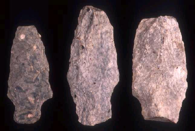
ABOVE: BARN01: Form variations within the Barnes point. Source: George Bradford, London Chapter, Ontario Archaeological Society General Description: (the following is from the London Chapter, Ontario Archaeological Society http://www.ssc.uwo.ca/assoc/oas/points/barnes.html): "Barnes points range from ca. 35- 105 mm in length (mean 61.2), 15-25 mm in maximum width (mean 21.5), 3.5-8 mm in thickness (mean 5.7), and 14-20 mm in basal width (mean 17.4). Basal concavity depth ranges from ca. 2-6 mm (mean 3.9).
SHAPE: Most points have "fishtails". Lateral base edges expand moderately from the "waist" above the fishtail to a maximum width at, or (if the point is largely unresharpened) just below midpoint. The points tend to be narrow and thick (width to thickness ratios of ca. 3-4.5 to 1) with marked biconvex or lenticular cross-sections. FLAKING: The points exhibit well-executed parallel-collateral flaking which terminates along the mid-line on each face. The ridge formed by these terminations down the mid-line was used as a guide for long (up to 80 mm), single, parallel-sided flutes. Flutes tend to extend to the tip on one face and from 1/2 to 3/4 of length on the other. There are never more than 2 flutes to a face. Often, the base of the flute has been widened and the base thinned by the subsequent removal of a single, short, broad flake (the "Barnes" finishing technique; see Roosa 1965). Lateral basal edges and basal concavities are lightly ground. RAW MATERIAL: In north south-western to south-central Ontario, most points are made on Collingwood (Fossil Hill formation) chert while in more southerly areas of Ontario, Onondaga chart is common. In eastern Michigan most points are on Bayport chert, while those in northern Ohio tend to be made on Tenmile Creek chert. AGE AND CULTURAL AFFILIATIONS: No C-14 dates are available for Barnes points but they are guess-dated to ca. 10,700 to 10,600 B.P. The points are somewhat similar to Cumberland fluted points found farther south. REMARKS: The Parkhill complex is probably the best known of all north-eastern PaleoIndian complexes but little has yet been published. Major excavations have been carried out at the Parkhill, Fisher and Thedford II sites in Ontario and the Barnes site in Michigan. Sites of the complex are often associated with the strandline of glacial Lake Algonquin. These points are named Barnes style after a site in Michigan where they were first reported in the 1960's. (source: Deller, B. and C. Ellis - 1984 Barnes Fluted Points. KEWA 84-6)
ABOVE: BARN02: common variations within the Barnes point form. Source: University of Western Ontario BARNES POINT THUMBNAIL GALLERY (50 images: 25 source images/25 thumbnails)
End of Barnes Thumbnails - Complete
ABOVE: BARN03: comparison of a Barnes point, second from left, and Cumberland points (all others). All are casts of the original points. The Barnes is from the Thedord II Site, Lambton Co., Ontario. The Cumberland points are all from the Trinity Site Cache, Lewis Co., Kentucky. Source: Pete Bostrom, Lithic Casting Lab (Lithiccastinglab dot com)
ABOVE: BARN04: Barnes point; Barnes Type Site, southern Midland Co., Michigan; additional images can be found below. Source: http://www.chippewanaturecenter.com/Oxbow/BARNES%20FLUTED%20POINTS.htm
ABOVE: BARN05: Barnes point; second in a series of seven images
ABOVE: BARN06: Barnes point; third in a series of seven images
ABOVE: BARN07: Barnes point; fourth in a series of seven images
ABOVE: BARN08: Barnes point; fifth in a series of seven images
ABOVE: BARN09: Barnes point; sixth in a series of seven images
ABOVE: BARN10: Barnes point; last in a series of seven images
ABOVE: BARN11: Barnes point biface; Barnes Type Site; southern Midland Co., Michigan
ABOVE: BARN12: probable Barnes point. Michigan
ABOVE: BARN13: Barnes point (Perino COA); Mason City, Illinois; 2.19 inches (54.75mm); first of four images
ABOVE: BARN14: second of four views of Barnes point described above in frame #13
ABOVE: BARN15: third of four views of Barnes point described in frame #13
ABOVE: BARN16: fourth of four views of Barnes point described in frame #13
ABOVE: BARN17: Barnes points from the Thedford II Site, near Thedford, Ontario, Canada
ABOVE: BARN18 AND BARN19: Barnes point; Elgin Co., Ontario, Canada; 2.6 inches (65mm). Source: Royal Ontario Museum
ABOVE: BARN20: Barnes point, one of six found in a cave on Lookout Mountain in Orange Co., New York; originally identified as Cumberland point but due to location outside geographic range for same, should be termed a Barnes according to the source; 2.38 inches (60.4mm); Kalkberg chert. Source: Pete Bostrom, Lithiccastinglab dot com
ABOVE: BARN21 AND BARN22: Barnes point; Brant Co., Ontario; 2.3 inches (59mm). Source: Royal Ontario Museum
ABOVE: BARN23: Barnes point; Indian Camp Run Number 1, Allegheny River, Forest Co., Pennsylvania. Source: Andrew J. Myers and Malinda Moses Myers (http://www.orgsites.com/pa/alleghenyarchaeology/_pgg10.php3) ABOVE: BARN24: source of Barnes point: terrace site, Indian Camp Run Number 1, Allegheny River, Forest Co., Pennsylvania. Source: Andrew J. Myers and Malinda Moses Myers (http://www.orgsites.com/pa/alleghenyarchaeology/_pgg10.php3)
ABOVE: BARN25: Barnes points; Parkhill Site, near Parkhill, Ontario, Canada, south og Grand Bend on the southeastern shore of Lake Huron. Source: Chris Ellis, Department of Anthropology, University of Western (http://anthropology.uwo.ca/cje/Parkhill.htmOntario) End of Barnes - Complete Badin to Barnes - Complete, end of this section! |
|
©2010 J Keffer |